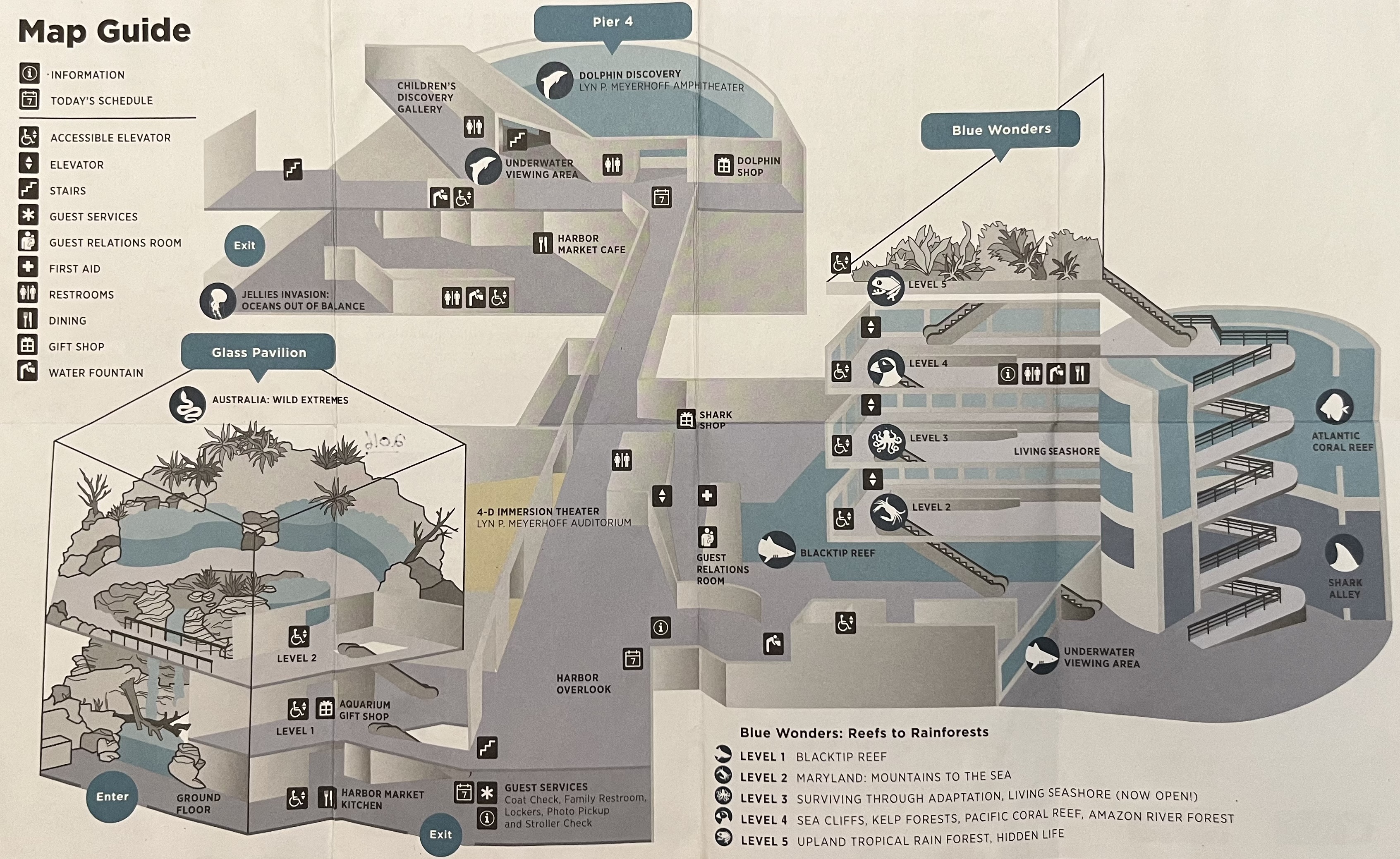
Funny how many times this map has changed even though the layout has been the same (with minor additions) since 2005. They don't actually even offer physical maps anymore!
I wonder if this is a hot take, but for me the National Aquarium was easier to navigate without a map than with one. On the map, Blue Wonders looks like a crazy maze of walkways, spiral ramps, and escalators, but in real life it is a single one-way path with very few intersections and it is incredibly intuitive to follow.
@ZooElephantsMan I feel like aquarium maps with multiple levels are really hard to make. There's difficulty in showing the layout of a multi story, multi building facility.
Here's a link to some of the older Aquarium maps. You can see they only ever used the floor layer spread once, simply because with each expansion it got complicated very quickly. Personally, the map from the early 2000s (up until 2003 when Australia was being built) is my favorite layout, but know it wouldn't necessarily work for the Glass Pavilion expansion.
Originally four bottlenose dolphins before they tried it with four belugas. When Pier 4 opened, the belugas moved over there with a new set of dolphins. They temporarily tried sea lions, but it was a nightmare with the barking in the cavernous Pier 3 building. It's been sharks and rays ever since 1991 (Wings in the Water up until 2013 and Blacktip Reef ever since).
The seals were a popular exhibit but were in the construction zone for Australia. The pool has been buried, but is now used for an underground cistern to water the Waterfront Park.