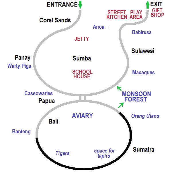
As there is no useful map of Islands, I thought a simple schematic like this might be useful. The footpaths are shown, the grey part is open now and the black part will open when the tigers and orangs are moved in. I have not attempted to show the meandering Lazy River or the bridges, except for the strange pair of bridges near the Bali Aviary. North is at the top. You go between the oryx and sitatunga to enter and leave towards the bears and bongo.