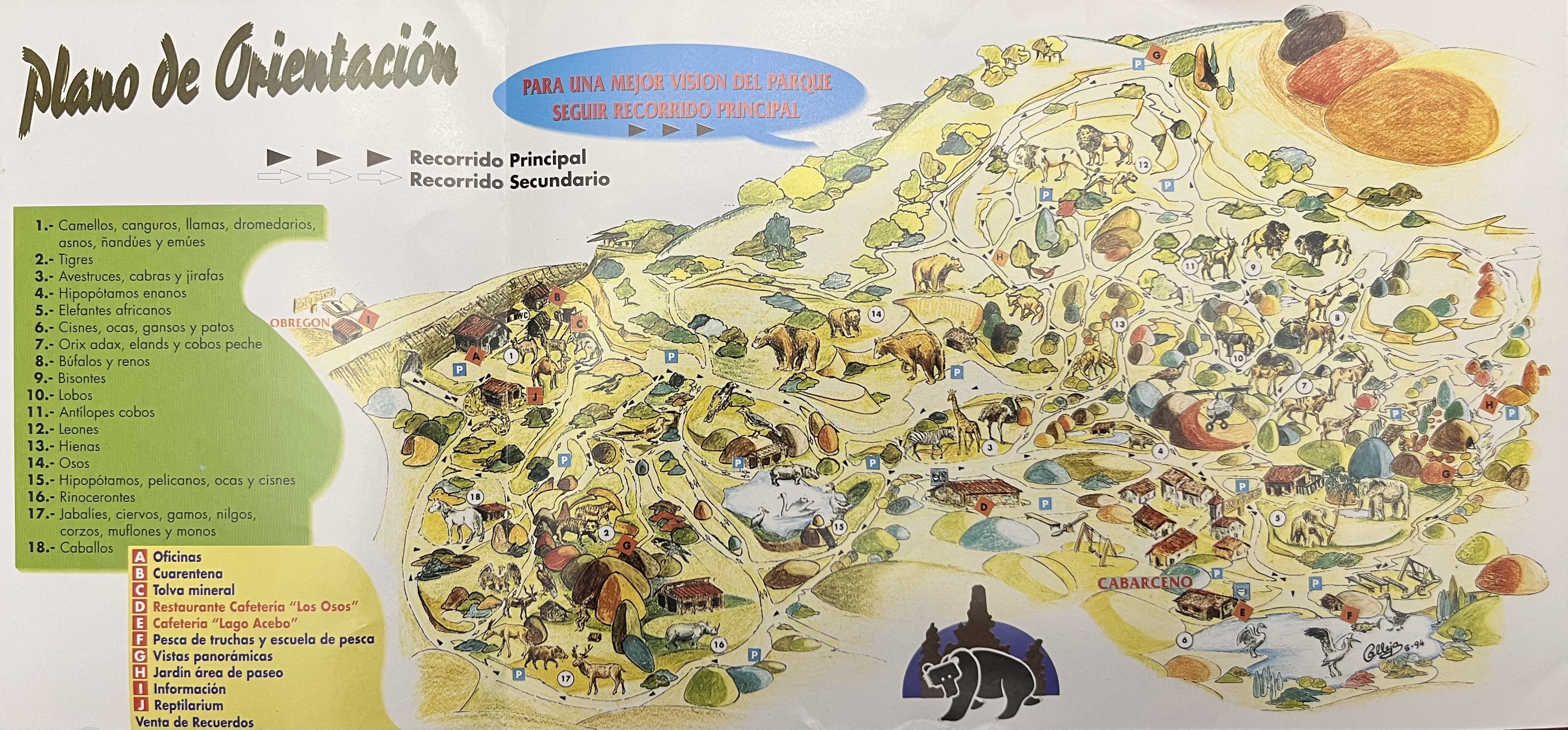
I've been looking for a clear scan of this map for ages, incredibly happy to see it here!
It depicts so many odd aspects of the park's early days, such as the fact that the current baboon and lynx exhibits weren't built or being used at the time, water buffaloes and reindeer in the current addax and cape buffalo paddock, what reads as a "fishing school" at the E point by the lake next to the elephants,... Such a weird time for the park.
I love that old logo, the silhouette of the bear in front of the rock formations really suits the feeling of the park. I also like the little illustrations of the wildlife within the zoo, but as a useful map seems like a pretty horrible one ahaha.
I'm always thrilled when I create a wave of nostalgia with all these old maps. Quite often there are zoo maps that aren't great in terms of showing visitors how to get around a park, but they are still full of character and charm.